Pattern Recognition
Sabrano analytical and documentary departments are backed by artificial intelligence and deep learning models, enabling easy integration of local knowledge.
Five strategic objectives of the World Heritage Convention are our guidelines: Credibility, Conservation, Capacity Building, Communication, and Communities.
Working with textual and imagery archives, we rely on fast processing of material through image recognition and large language model frameworks that are constantly perfected.
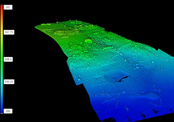
Integration with LiDAR mapping involves:
-Data layers in QGIS or ArcGIS, with
- Overlay detection of features on construction plans
- Export of 3D models and maps for site evaluation
-Field Validation and ground-truth verification at flagged locations